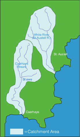
River Catchments - ST AUSTELL
STREAM or WHITE RIVER
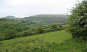
The St Austell River or ‘White River’ Catchment covers an area of approximately 15km2. The north of the catchment has undergone huge topographical changes due to China Clay mine works over the years. The river is known locally as the White River as a reflection of the clay residues that enter the watercourses during periods of heavy weather. Much of the land is either being mined, is spent mined land, or has tenant farmers in occupation. However, the hamlets, villages and communities of the area have gone, the village of Greensplatt being an example of one of them. All around, between the clay pits and tips, lay the remnants of ancient farmsteads and field systems – now abandoned.
The spent mined land is now undergoing the first stages of re-colonisation and some interesting plant species exist. Some of the land was moorland and heathland before the mining works began, and some of these indicator species are returning – namely gorse, bracken, alder and broom. Unfortunately, rhododendron and Japanese Knotweed have spread prolifically through this virgin territory, and the landowners have a real problem trying to contain them.
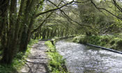
The busy town of St Austell is situated at roughly the centre of the catchment. From this point the river has been the subject of a canalisation programme. It has lost all natural features and is subsequently subject to related problems such as bank erosion and is under pressure from many user-groups including joggers, dog walkers, impromptu campers, mountain bikers, etc.
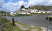
In the lower reaches of the catchment holiday parks, campsites and garden centres abound. The river reaches the sea at Pentewan Sands; the harbour (for which the original flushing ponds can still be found in nearby woodlands) is being developed into residential properties.
It is estimated that approximately 75% of the farmed area of the catchment has been visited by the Westcountry Rivers Trust; and this was during the last year of the project. This equates to 18 farms and 1,188 ha, with advice given predominantly on erosion control measures and prevention of soil loss. Grant assistance has been given on 454 m of fencing. Other main areas of advice have been on fertiliser reduction, clean water separation, injurious weed control (thistles, nettles and docks) and control of the spread of Japanese Knotweed.