River Catchments
- CAERHAYS
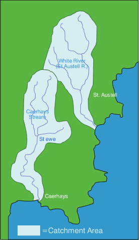
Neighbouring the Fal, White and Mevagissey Rivers, the Caerhays River is located on the south coast of Cornwall a few miles to the east of Mevagissey. The Caerhays Stream is 13km in length and runs north-south, discharging into the English Channel at Porthluney Beach.
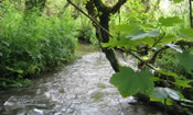
The Caerhays Catchment comprises principally steep-sided river valleys resulting in marshy river margins. There are many spring-fed tributaries and the upper reaches have been impacted by historical mineral/metal mining activities.
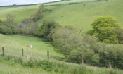
The catchment is dominated by agriculture and over two thirds of the farms have been visited through CRP covering a total area of 1,357 hectares. Several farms within the catchment are in Environmental Stewardship agreements mostly near the coastal strip which is a target area. The farming activities in the catchment are predominantly livestock based, comprising a mixture of dairy cattle, beef cattle & sheep. In addition to this, a significant amount of land is in cultivation as bulb fields and arable land, principally maize. Visits to the Caerhays were undertaken in the final year of the project only and there were few physical works installed. Over 26km of watercourses were surveyed from the mainstream to minor tributaries.
There is little urban development in the catchment with the exception of Sticker village and Hewas Water on the east and west branches of the headwaters, respectively. The village of St Ewe is situated within the catchment, and is served by a sewage treatment plant that discharges into the Pengrugla tributary. Tourism plays a major part in the economy of the area and there are several campsites and farm B&Bs located within the catchment.