landscape
management - mapping the landscape Exercise
To complete this task you will
need to look carefully at the other information in this section,
especially the diagrams which explain the processes that are happening
on land, and the way land is managed to help rivers.(L06a
– L06k).
Answer the following questions:
1. What
is the type of land management called when trees are cut down and
allowed to re-grow?
2.
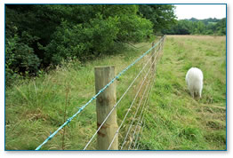
What is the zone, or area, called that is created between a river
and an agricultural field to protect the river there?.
3.
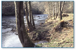
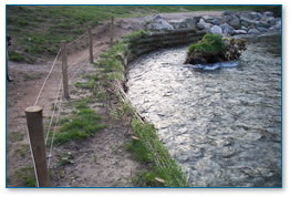
What are the bank protection structures called that are put into
a river to help prevent bank erosion?
Now you are going to apply your
knowledge to a real situation and look for evidence of river and
stream processes and land management work.
On your field trip you will visit
a stream or river and the area close by it. Think back to the ‘Background’
section of this CD when the water cycle was explored (B02),
have another look at it to refresh your memory.
The important thing to remember
is that when we look at what is happening in a stream or river we
must also look at what is happening to the water before it reaches
that stream or river. This will affect the water quality. Some land
management activities tackle this, for example silt trapping (L06a).
Field work
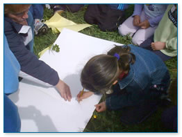
• When you reach the field
study site, as a class you will be given a large sheet of card.
Select a cartographer (a person who draws maps) to draw a large
plan of the field you are in.
• Mark on the plan: the
river/stream and the entrance you came through, and the compass
points: north, south, east and west.
• In a small group with
2 or 3 other people you will be given a card with details of a process
or land management work which is happening at the site you are visiting.
(there might be two groups with ‘erosion sheets’, for
example, the challenge for the two groups is to find different examples
of erosion at the site).
• Now choose a name for
your group, something that fits in with the environment you are
in like ‘the knowledgeable water nymphs'; remember your group
name.
• When you have found a
place where your process or land management work is happening go
back to the large sheet of card and mark where it is on the plan
in writing along with your group’s name.
• Have a go at drawing
a picture of the place where the process is happening or land management
work being done. You or your teacher may be able to take a photograph.
• After everybody has marked
on the plan where evidence exists of the process or land management
work they have on their card, there will be a guided tour of the
site.
• Your teacher will carry
the plan around the site, but it is you and your classmates who
will explain where the processes or management is happening and
introduce it to the rest of the group.
• Your card will help you
to understand what the process or land management work is. You must
explain this to the rest of the group when you reach the place at
the site where you found evidence of the process happening or management
taking place. Your teacher will hand over to each group in turn,
introducing them by their group name.
• Remember to include in
your explanation what is happening to the water, for instance; where
it is moving – this could be under ground or over ground for
example.
• When you get back to
school use your plan to make a wall display. On the display you
could include writing about the processes and land management work
found at the site and the pictures you drew on your field trip.
Make your display bright and eye catching, have a go at drawing
pictures to show the group names, what might the ‘curious
cased caddis’ look like?
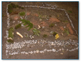 |
Map of the river
using natural materials |
Take a photograph of your display,
and send it to the Westcountry Rivers Trust, it might just appear
on the website!
• Whilst you are at the
site you might also be able to produce a map of the river on the
ground using natural materials and take a photograph of that.
Some examples of these land management
issues and methods can be found on the Trust’s Demonstration
Sites – visit the WRT website for information on Demonstration
sites currently available for visits – www.wrt.org.uk
|