camel
and allen
 Rising
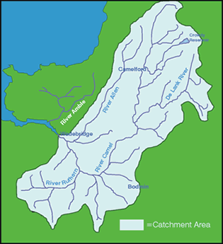
at 280m on Hendraburnick Down, the river Camel drains a 413km2 area
between Bodmin Moor and St Breock. With an average gradient of 7m/km,
it flows for approximately 40km before joining the sea near Padstow.
The river Allen is a major tributary of the Camel and enters the
Camel estuary just upstream of Wadebridge. The catchment is mainly
made up from sandstones, slates and shales, with granite being found
closer to Bodmin Moor. Historically, mining and quarrying was once
an important industry with slate quarrying still occurring at Delabole,
towards the top of the river Allen. Redundant coastal lead mines
now form an important habitat for bats. Rising
at 280m on Hendraburnick Down, the river Camel drains a 413km2 area
between Bodmin Moor and St Breock. With an average gradient of 7m/km,
it flows for approximately 40km before joining the sea near Padstow.
The river Allen is a major tributary of the Camel and enters the
Camel estuary just upstream of Wadebridge. The catchment is mainly
made up from sandstones, slates and shales, with granite being found
closer to Bodmin Moor. Historically, mining and quarrying was once
an important industry with slate quarrying still occurring at Delabole,
towards the top of the river Allen. Redundant coastal lead mines
now form an important habitat for bats.
The upper and middle reaches
of the Camel are essentially moorland, passing into woodland. Most
of the land is undulating farmland, principally livestock farming,
with mixed farming/rough grazing on the poorer land. Indeed, agricultural
land covers approximately 93% of the catchment.
The Camel Valley is currently
designated as a Special Site of Scientific Interest (SSSI) and has
also been attributed candidate Special
Area of Conservation (SAC) status
under the EU Habitats Directive, due to the presence of otters and
bullheads. Further designations include Area of Outstanding Natural
Beauty (AONB) status for the Camel estuary and Area of Great Landscape
Value (AGLV) status for the Camel and Allen valleys.
 |
 |
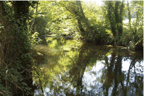
| River
Camel downstream from Poleys Bridge |
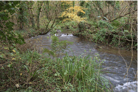
A
section of the middle Allen in high flow |
Many species, including some
rare ones, can be found in the Camel and Allen catchment including
bullheads, the pearl bordered fritillary, lamprey, eels, cockles
and many other red data book species. The Camel and Allen rivers
have been recorded as being amongst the most productive rivers for
salmon and sea trout in the South West, due to their high water
quality, suitable flow regimes and appropriate habitats.
|

