fowey
and lerryn
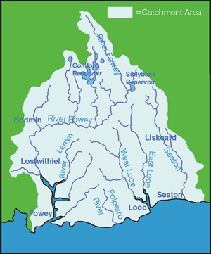
The river Fowey is one of the
largest river catchments in south Cornwall, draining an area of
approximately 177.5km2 from central and southern Bodmin Moor. Importantly,
the catchment includes two strategic reservoirs - Colliford and
Siblyback - which supply water to a large part of the county's population.
The river rises on Bodmin Moor
at a height of 290m, flowing in a southerly direction for approximately
35km before reaching the tidal limit at Lostwithiel. The estuary
continues for a further 9km before reaching the coast at Fowey town.
There are several tributaries that enter the Fowey estuary, the
largest of which is the river Lerryn.
The geology of the Fowey catchment
varies from igneous granite on Bodmin moor, through to Devonian
slates in the middle reaches and Straddon grits and Meadford beds
in the lower part of the catchment.
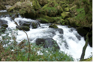
| |
| Golitha
Falls on the Fowey |
Copper and china clay mining
have been major activities within the catchment, leading to contamination
from metalliferous compounds and sediment. Although contamination
levels are no longer considered to cause major water quality problems,
disused china clay mines continue to act as a source of suspended
solids.
The landscape of the catchment
is characterised by heathland, moorland and rough pasture in the
upper reaches and broadleaf, coniferous and mixed plantation woodland
in the middle and lower sections.
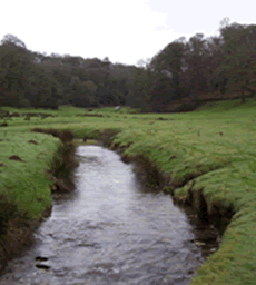
| |
| River
Lerryn near Lostwithiel |
The majority of the catchment
is rural, the only notable urban areas being Lostwithiel and Fowey
town.
There are 4 SSSIs within the
catchment, in addition to the majority of the upper catchment being
designated as an Area of Great Scientific Value (AGSV) and also
an Area of Great Historical Value (AGHV).
|